")
")


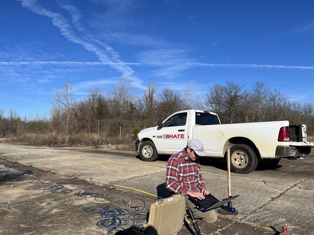
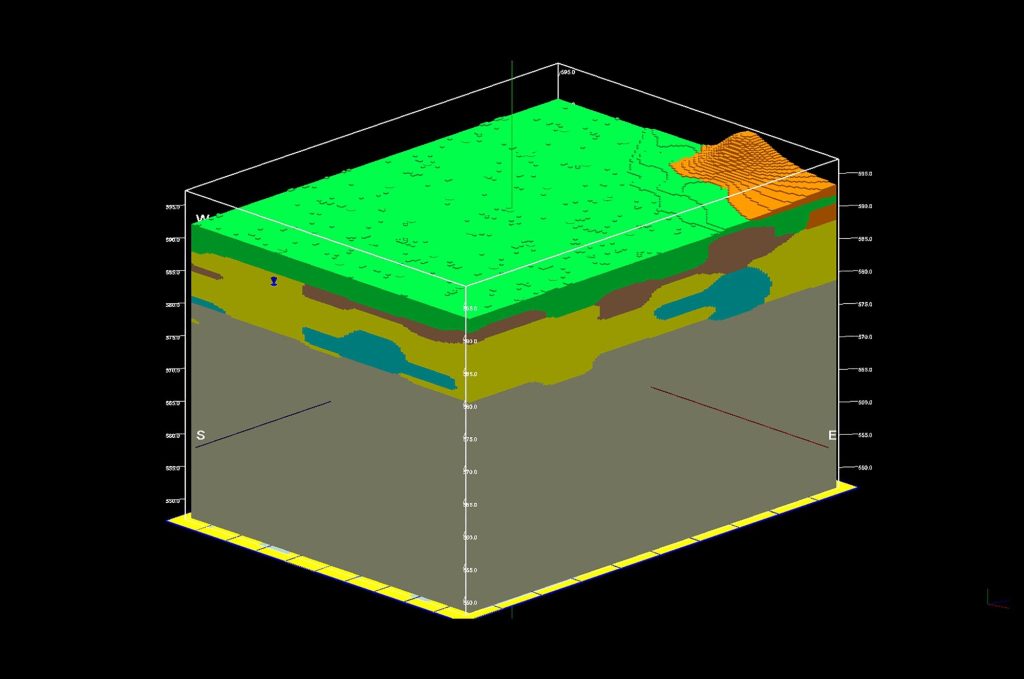
BHATE Geosciences’ Geophysics Group brings over 50 years of geophysics data acquisition and processing experience and technical leadership with a clear focus on our clients’ needs. Geophysical exploration is often conducted for independent use and to supplement geotechnical data. With our technology, meaningful 3-D models can be created using a combination of field exploration and geophysical mapping for site characterization of natural and underground manmade conditions. Our day-to-day geophysics capability includes:
Refraction and Reflection Seismology: Determines the depth and velocity of rock layers by analyzing refracted seismic waves generally used for mapping structures within the upper 100’. This method is also commonly used for Site Seismic Classification for building design purposes. Seismic Reflection methods can be used for deeper exploration.
Electrical Resistivity Tomography (ERT): Measures electrical resistivity of the subsurface at different depths to image geological structures, bedrock, and identify subsurface voids, groundwater contamination, and locate buried structures.
Electromagnetic Methods - Ground Penetrating Radar (GPR): Uses high-frequency electromagnetic microwaves to generate subsurface images with high resolution, useful for detecting shallow buried objects and mapping near-surface geological features.
Other geophysical methods are available in our portfolio, but generally less frequently used.
Common uses of the technology include:
Environmental Studies: Investigating contaminant plumes, identifying potential waste sites, and monitoring remediation.
Engineering Site Investigations: Assessing subsurface conditions for construction projects, karst conditions, underground mines, bedrock profile, ground loss and voids, and identifying potential subsurface failures and other applications.
Archaeological Studies: Locating buried archaeological features by detecting changes in subsurface physical properties
Advantages of Geophysical Methods:
Non-destructive - Ideal for use in populated areas or structures in active use with minimal disruption
Cost-effective - geophysics does not require excavation or direct access to subsurface except for subsequent localized validation of findings and provides a means of evaluating large areas rapidly. Combinations of geophysical methods can provide the means of applying different techniques to solve complex problems.
Proven – Many of these techniques have been in existence for more than half a century. BHATE has been commercially working with geophysics exploration for over 40 years.

Learn more about our
Geophysics Services
Josh Bhate
LEED AP, QCxP, CxA, CxA+BE
Chief Operations Officer
jbhate@bdandps.com